Daily updates
New incidents are ingested every day from live public feeds, keeping your analysis current without manual refreshes or stale snapshots.
Get access to a national crime event dataset with daily updates, standardized NIBRS offense mapping, and geocoded locations across 150+ U.S. metropolitan areas. Smiles Printed Data Services delivers actionable incident intelligence for analysts, insurers, and researchers who need reliable, normalized crime data at scale.
National coverage with daily refreshes from municipal and county open-data sources
The dataset
We aggregate incident-level crime data from public municipal and county sources, normalize fields to a shared schema, and enrich records with geography and offense classification — so your team can analyze crime patterns without building pipelines city by city.
New incidents are ingested every day from live public feeds, keeping your analysis current without manual refreshes or stale snapshots.
98% of records include latitude and longitude, enabling point-level mapping, proximity analysis, and spatial joins to your own assets.
73% of offense types are mapped to NIBRS codes for consistent cross-jurisdiction comparison — no more reconciling incompatible local charge descriptions.
Schema definition
Every incident is normalized to the same schema — offense classification, vendor-specific details, geocoded location, and census geography enrichment in one analysis-ready row.
| Field | Type |
|---|---|
date | date |
case_no | string |
report_date | date |
occured_date | date |
| Field | Type |
|---|---|
nimbrs_code | string |
nimbrs_code_projected | int |
nimbrs_description | string |
crime_vendor_type | string |
crime_vendor_description | string |
| Field | Type |
|---|---|
location | string |
location_lon | float |
location_lat | float |
location_lon_lat_projected | string |
location_bg | string |
location_county | string |
location_msa | string |
location_zcta5 | string |
Download data sample
Download a CSV sample with representative incident rows — including NIBRS offense mapping, vendor-specific fields, geocoded coordinates, and census geography enrichment (MSA, county, ZIP).
Download sample CSVdate,case_no,nimbrs_code,location_msa,location_zcta5,...
2025-08-14,2025-041882,23F,San Francisco-Oakland-Berkeley CA,94102,...
2025-08-14,2025-118203,120,Chicago-Naperville-Elgin IL-IN-WI,60614,...
2025-08-13,25-089441,220,Los Angeles-Long Beach-Anaheim CA,90027,...Explore coverage
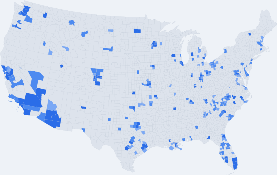
Coverage is mapped at the county level across the United States. Heat intensity reflects incident density and enrichment completeness in each county.
Why Smiles Printed Data Services
Municipal crime data is scattered across dozens of portals, APIs, and file formats. We handle discovery, ingestion, normalization, and enrichment — delivering a single, analysis-ready dataset instead of a patchwork of one-off integrations.
Contact our sales team to discuss coverage, delivery formats, and licensing for your use case.
smilesprinteddata@gmail.com